
Did Serge’s “end of the world” post convince you that Ushuaia is the real end of the world?
I hope not… But never mind, this post should shed some more light on the matter and finally settle that Chile has the “end of the world”est settlement!
—
E’ riuscito Serge con il post “fine del mondo” a convincervi che Ushuaia è la vera fine del mondo? Spero di no … Ma non importa, questo post dovrebbe finalmente chiudere la questione e stabilire una volta per tutte che il Cile ha l’insediamento più alla “fine del mondo”!
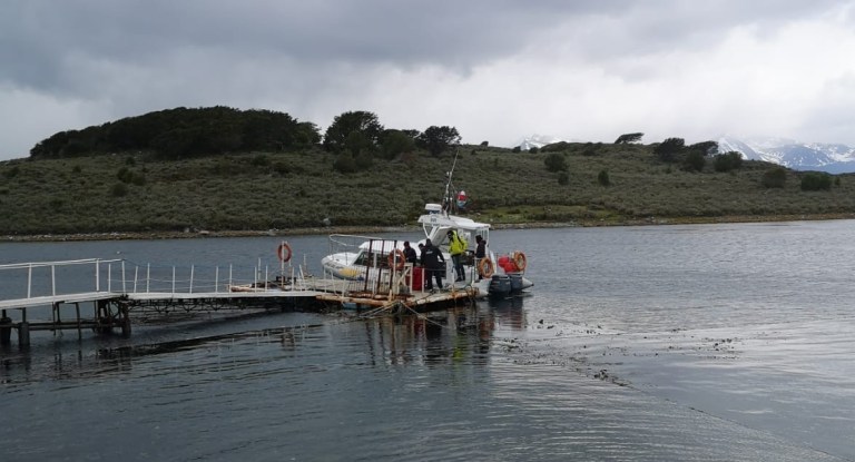
To get to Puerto Williams (Ushuaia’s counterpart), you first need to cross the Beagle channel by boat (picture of our boat below) to Puerto Navarino (about 20mins) and then, after some immigration admin, enjoy a 1.00-1.30h bus ride on gravel road to Puerto Williams. The untouched landscape fills your eyes with beauty.
—
Intanto, per arrivare a Puerto Williams (controparte Cilena di Ushuaia), bisogna prima attraversare il canale Beagle in barca da Ushuaia (sotto una foto della nostra barca) fino a Puerto Navarino (circa 20 minuti) e poi, dopo qualche procedura per l’immigrazione, ti attendono 1.00-1.30h di autobus su strada sterrata fino a Puerto Williams. Il paesaggio incontaminato riempie gli occhi di bellezza.
When you finally arrive in Puerto Williams, you find yourself in a very small and tight community of about 2000 people, with a handful of restaurant and a number of modest but pricey accommodation options. The first settlers on the island were military people, as Puerto Williams was initially a naval base for Chileans to establish their presence in the area.
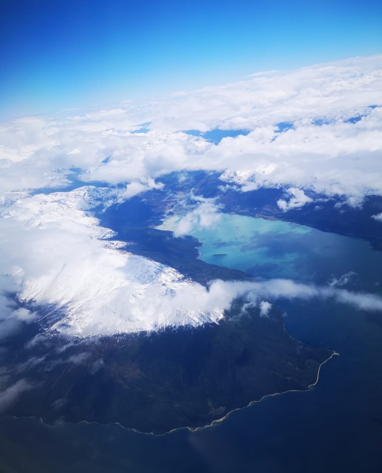
The town is connected to the rest of Chile by either plane (the tiny airport has 1 daily 40-minute flight to Punta Arenas, the regional main city in the Magallanes region) or by weekly ferry to Punta Arenas (c. 30h navigation); the weekly ferry also supplies the town for the whole week with food and other goods. The ferry does a very nice itinerary among the fjords and that was the option we would have gone for, if the ferry had not been delayed/cancelled. Taking the plane however gave us the opportunity to receive the most sustainable and interchangeable boarding passes we had ever seen and to have some decent views 😎 on the Beagle channel.
—
Quando infine arrivi a Puerto Williams, ti ritrovi in una piccola comunità di circa 2000 persone, con una manciata di ristoranti e qualche alloggio modesto ma costoso. I primi coloni sull’isola sono stati militari, poiché Puerto Williams è stato inizialmente una base navale per garantire una presenza Cilena nella zona.
Il paese è collegato al resto del Cile tramite o aereo (il piccolo aeroporto ha 1 volo giornaliero di 40 minuti per Punta Arenas, principale città nel regione del Magallanes) o tramite traghetto settimanale per Punta Arenas (c. 30h di navigazione); il traghetto rifornisce anche la città per tutta la settimana con cibo e altre merci. Il traghetto compie un itinerario molto scenico tra i fiordi; questa sarebbe stata la nostra opzione per il ritorno ma il vento forte in Punta Arenas ha ritardato / cancellato il traghetto. Prendere l’aereo tuttavia ci ha dato la possibilità di ricevere le più sostenibili ed intercambiabili carte d’imbarco mai viste e di godere di qualche paesaggio decente 😎 sul canale Beagle dall’alto.

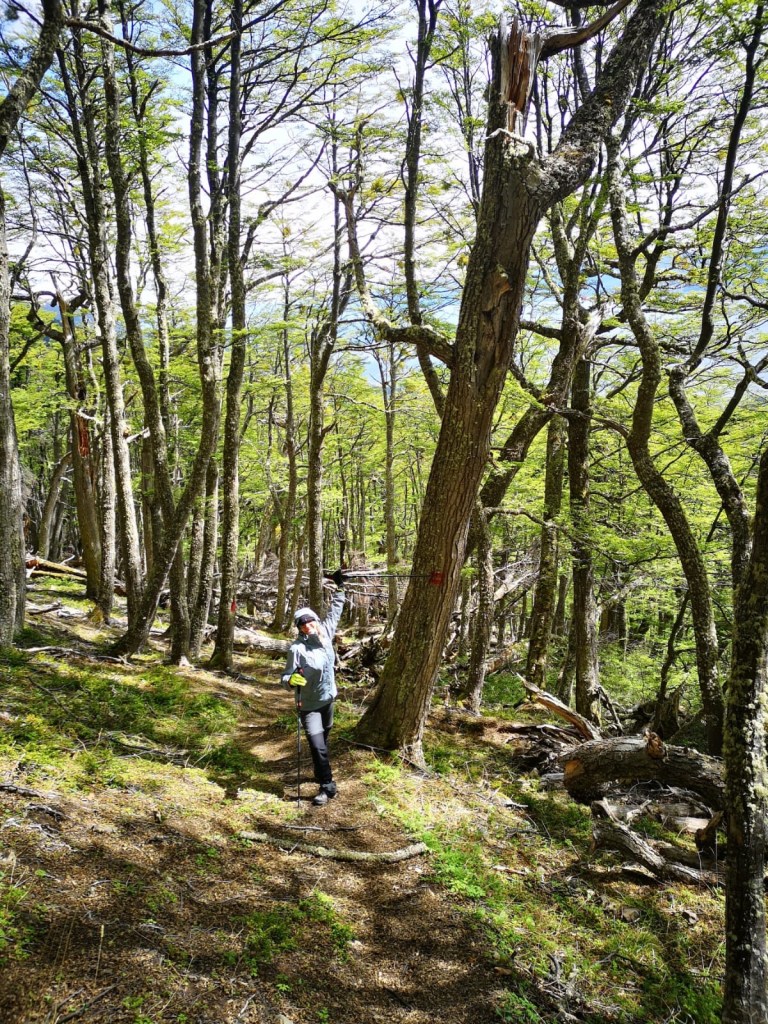
The main attraction of Navarino island (where Puerto Williams is) is the Dientes (literally “teeth” given the shape of the peaks) de Navarino circuit, a hiking trail that requires c.4 days to complete. Given how remote Puerto Williams is, the trail is not very crowded and the path is less marked than you would expect (in the picture, you can see an example of when the path is more visible).
—
L’attrazione principale dell’isola Navarino (dove Puerto Williams è situata) è il circuito Dientes de Navarino, un sentiero che richiede c.4 giorni di cammino. Siccome Puerto Williams è situata in una località molto remota, il sentiero non è per niente affollato e il percorso è meno marcato di quanto ci si aspetterebbe (nella foto, si può vedere un esempio di quando il percorso è più visibile).
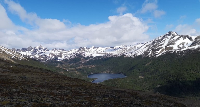
We did not have enough time to complete the circuit, but below is a taste of the views you can enjoy from the highest point of the circuit (650m up from Puerto Williams), both on the mountain side with the “dientes” and on the channel side.
—
Non abbiamo avuto abbastanza tempo per completare il circuito intero, ma di seguito potete vedere il paesaggio che si gode dal punto più alto del circuito (c. 650m più in alto rispetto Puerto Williams), sia lato montagna con i “dientes”, sia lato canale.
See, when it’s sunny, life is not too bad at the end of the world!!
—
Alla fine quando c’è il sole, non si sta poi così male alla fine de mondo!
